Vintage Maps of Ortelius – 16th century – Vol 1 – Cascoly Image Galleries

Cascoly royalty-free image galleries are supplements to our blog posts on individual travels, allowing display of many more images than are reasonable within those posts.

More vintage maps as prints or merchandise

Antique Map of the World, Antique map by Ortelius, circa 1570

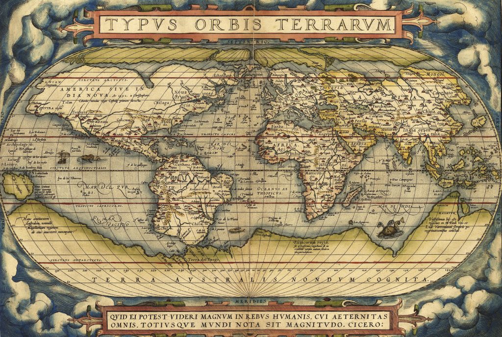
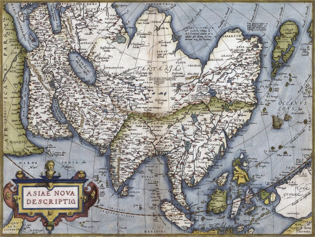
Abraham Ortelius, a Flemish cartographer and geographer, is celebrated for his significant contributions to early modern cartography. Born in 1527 in Antwerp, he is best known for creating the first modern atlas, the “Theatrum Orbis Terrarum” (Theatre of the World), first published in 1570. This work was groundbreaking because it compiled maps from various sources into a uniform format, accompanied by detailed descriptions, making it accessible and informative for its audience.

Antique Map of Africa vintage chart by Abraham Ortelius, circa 1570
Antique Map of Portugal, vintage chart by Abraham Ortelius, circa 1570
Antique Map of France, vintage chart by Abraham Ortelius, circa 1570
Antique Map of Germany and the Netherlands vintage chart by Abraham Ortelius, circa 1570

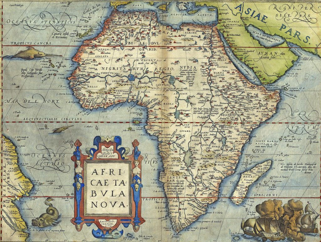
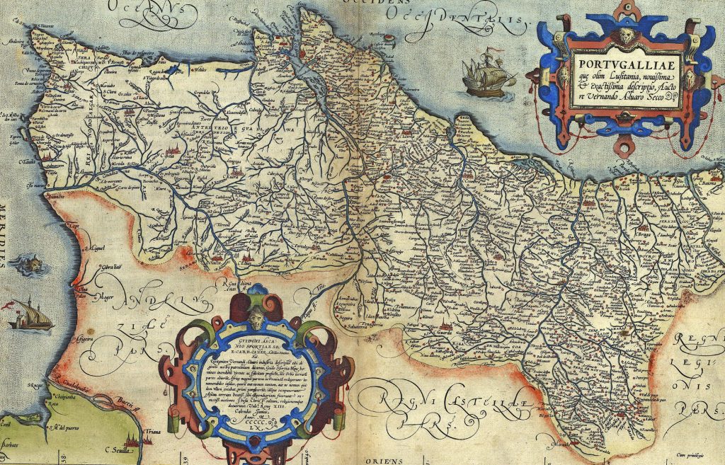
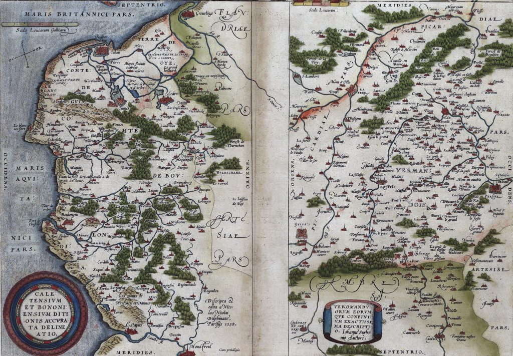
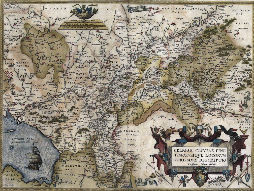
Ortelius’s maps are highly valued for their artistic quality, historical significance, and the insight they provide into the geographical knowledge of the 16th century.

Antique Map of Portugal, vintage chart by Abraham Ortelius, circa 1570
Antique Map of the Rhine River between France and Germany vintage chart by Abraham Ortelius, circa 1570

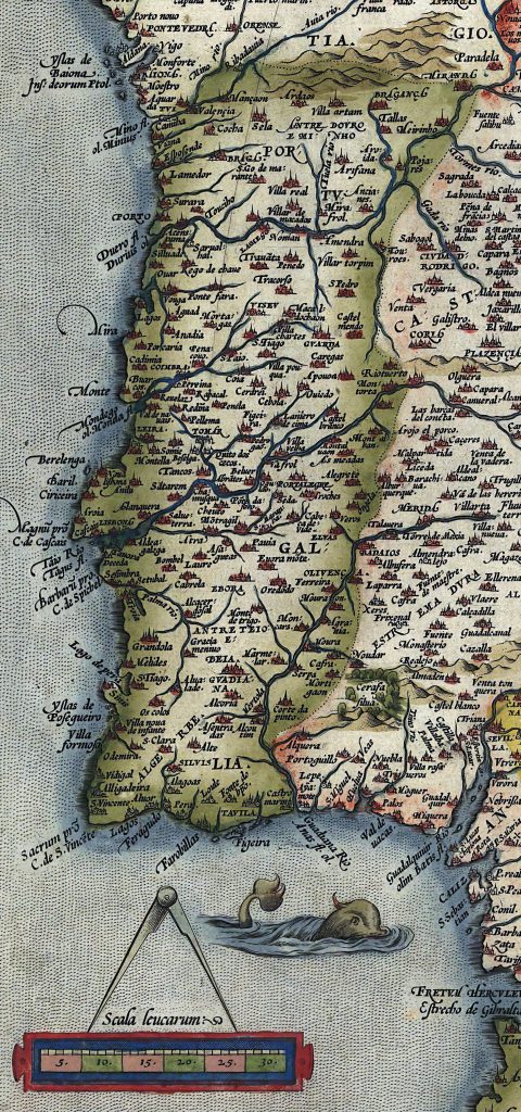
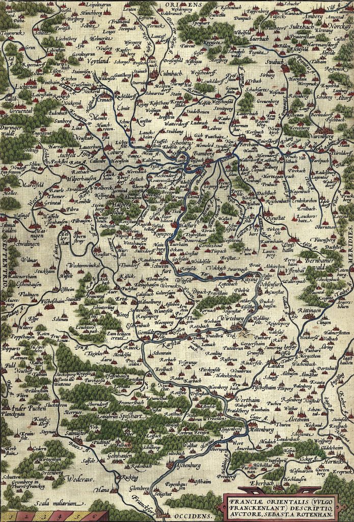
His maps are known for their detailed and decorative elements, including elaborate cartouches, mythological figures, and sea monsters. These features not only made the maps visually appealing but also served to convey cultural and political messages. One caveat – as commonly drawn at that time, many maps do not put north at the top. We need to use the placement of Orient (east) and Occident (west) to ‘orient’ ourselves.

Antique Map of Flanders, vintage chart by Abraham Ortelius, circa 1570
Antique Map of Holland, vintage chart by Abraham Ortelius, circa 1570
Antique Map of Bohemia with Prague, vintage chart by Abraham Ortelius, circa 1570
Antique Map of Switzerland vintage chart by Abraham Ortelius, circa 1570

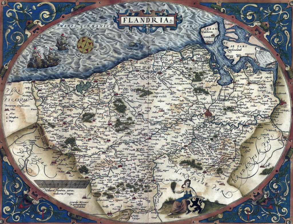
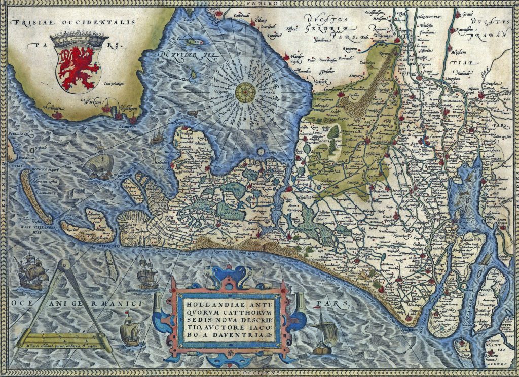
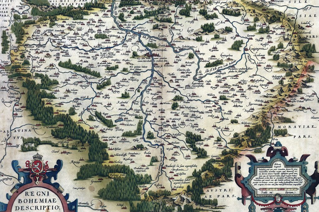
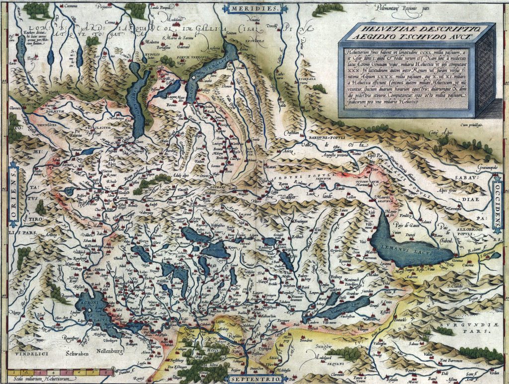
While the maps reflect the knowledge and limitations of the period, Ortelius was meticulous in compiling the best available data. His atlas included corrections and updates in subsequent editions, demonstrating a commitment to improving accuracy.

Antique Map of Piedmont Italy, vintage chart by Abraham Ortelius, circa 1570
Antique Map of Italy, vintage chart by Abraham Ortelius, circa 1570

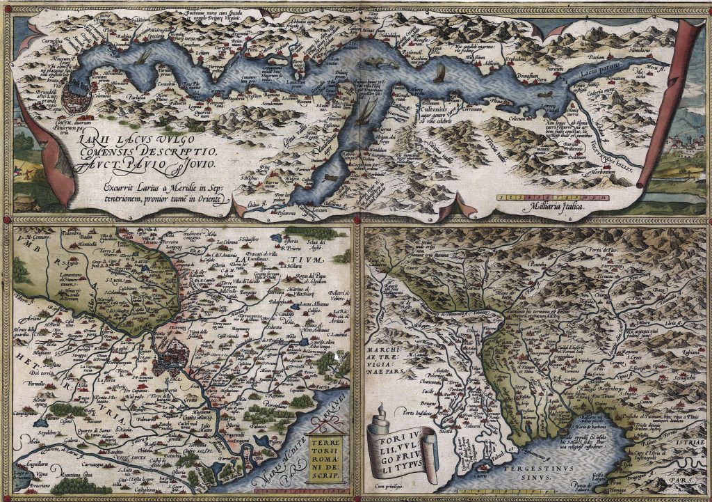
Ortelius’s maps provide a snapshot of the world during the Age of Exploration. They reflect the European perspective of global geography, including the latest discoveries and territorial claims.

Antique Map of Sicily, Elba, Malta and Corfu vintage chart by Abraham Ortelius, circa 1570. Western Mediterranean
Antique Map of Cyrpus, Candia and Crete vintage chart by Abraham Ortelius, circa 1570. Eastern Mediterranean

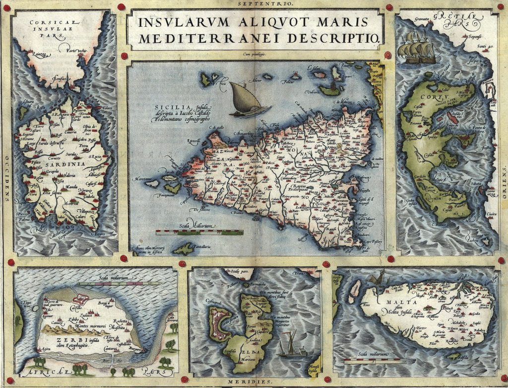
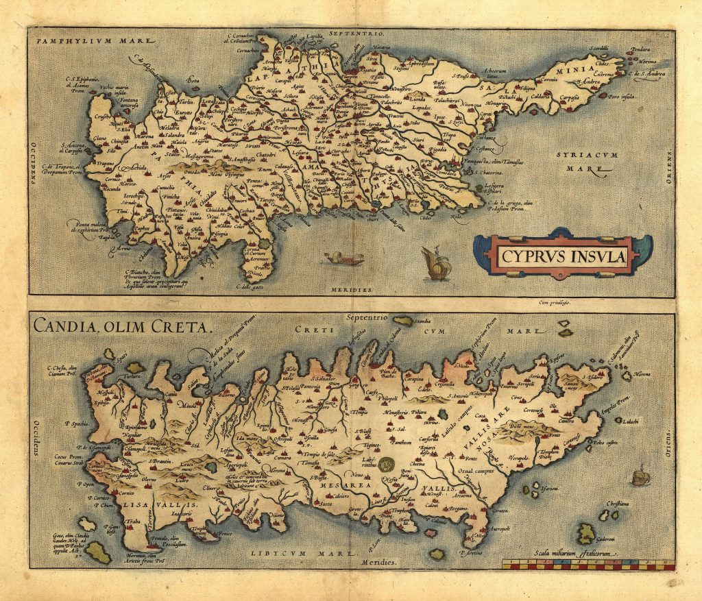
Ortelius worked with other prominent cartographers of his time, such as Gerardus Mercator. His maps often incorporated data from explorers, scholars, and earlier maps, synthesizing a wide range of information.

Antique Map of Transylvania, Romania vintage chart by Abraham Ortelius, circa 1570
Antique Map of Poland and the Baltic Sea, vintage chart by Abraham Ortelius, circa 1570
Antique Map of Egypt and Palestine vintage chart by Abraham Ortelius, circa 1570
vintage maps
Antique Map of Egypt and Palestine vintage chart by Abraham Ortelius, circa 1570
Antique Map of the North Sea - England, Scandinavia and Iceland  vintage chart by Abraham Ortelius, circa 1570
Antique Map of the North Sea – England, Scandinavia and Iceland vintage chart by Abraham Ortelius, circa 1570

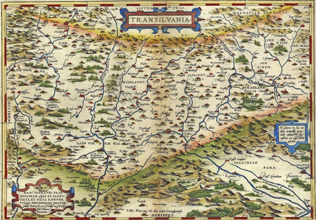
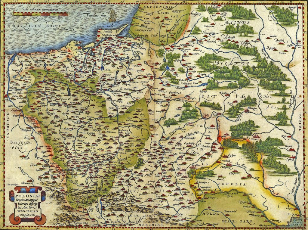
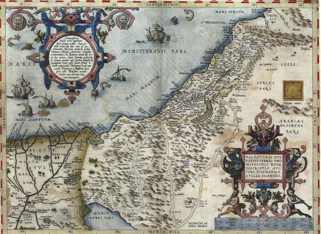
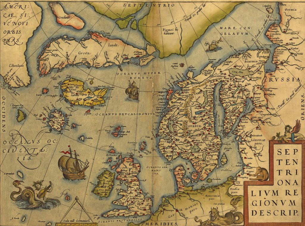
The “Theatrum Orbis Terrarum” set a new standard for atlases and influenced cartography for generations. It was widely used and translated, cementing Ortelius’s reputation as a pioneering figure in mapmaking.

More history blogs

Antique Map of Asia,  vintage chart
Antique Map of Asia, vintage chart

Many of these images are available as framed prints, greeting cards, coffee mugs, and other merchandise; others can be provided on request. Or you we can email you a large format, royalty free image beginning at $5 for non-commercial use, including on your website or blog and social media. Use the form below to enquire about particular images or order complete galleries at huge discounts. Your emails are never made public, and we neither share nor sell personal information to anyone.  Check our license page for details on our royalty free license. 

Price for your first gallery: $30 for 6MP++ (3000 x2000 or equivalent)

20% discount on 2 – 4 galleries
30% discount on 5 or more

Select your choices & we’ll send an invoice reflecting any discounts. Payment by paypal or credit card accepted. All images are delivered digitally.

Sorry, but no returns on digital items.

By Cascoly

I've been exploring and leading trips for over 40 years. climbing & trekkng in the Alps, Andes, North American mountain ranges and the Himalaya. I'm retired from mountaineering now but world travels in Europe, Africa & Asia continue to expand my portfolio. Besides private travel, I now focus on escorting trips to India & Turkey. Other interests include wide reading in history and vegetable gardening / cooking. You can download digital images here, or find images at https://steve-estvanik.pixels.com. We have many thousands of images we haven't displayed yet; so, if you have a special need or request please contact us